Find an answer
What would you like to know?
Choose a common question or type your own. Your question is matched to the answers below.
Answer from our published position
The wider road network
Current and proposed restrictions in one view
The map brings the different measures together across Queen’s Park Ward. Individual restrictions have been introduced or proposed through separate schemes.
Our concern is their cumulative effect on the wider network, including roads left outside the restricted areas.
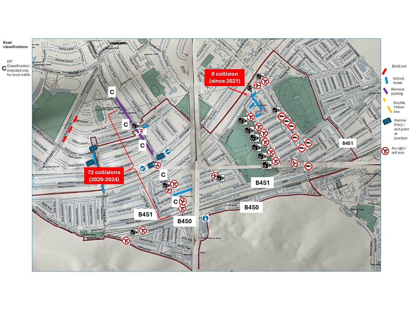
Map supplied by Queen’s Park Ward councillors. It brings current and proposed measures onto a single ward-wide view; it does not claim that every measure has the same legal status or operating hours.
Our full position
Seven key questions
01Do we agree there is a problem?
Yes. The study identifies genuine problems with school-run traffic, unsafe parking and driver behaviour around Chevening Road. We do not dispute that.
02Why don’t we support the proposed School Street in its current form?
Recognising a problem does not automatically mean this particular proposal is the right response. We remain unconvinced that the case has been sufficiently demonstrated for another traffic restriction, particularly alongside the existing Avenues ETOs and uncertainty about their combined effect on the wider road network.
03Haven’t the consultants responded to your concerns?
Yes, and we have considered their responses carefully. We don’t expect every impact to be known in advance. Our question is whether the available evidence gives sufficient confidence about the likely wider effects of traffic and parking displacement, and the combined effect with the existing Avenues ETOs, to justify another restriction.
04Hasn’t the study looked at the Avenues and surrounding roads?
Yes, and we recognise its findings. Our concern is the cumulative effect of adding another restriction to an already altered road network. The report says wider network and cumulative effects would continue to be assessed through consultation and, if implemented, experimental monitoring.
05What about the traffic data?
The latest counts provide useful evidence of current conditions with the Avenues ETOs in place. However, the report acknowledges that historic surveys were undertaken at different locations and stages of the ETO rollout, limiting straightforward like-for-like comparison of how traffic has changed and redistributed over time.
06If you don’t support the proposals, what would you do instead?
Doing nothing isn’t our position.
School Street: The study discusses measures including safer crossings, Park & Stride and drop-off arrangements. We believe these merit further consideration and, where practicable, testing, alongside targeted enforcement and work with the schools.
Avenues ETOs: We recognise the original problem of rat-running and through-traffic. We want the consultation evidence and traffic data used to develop a proportionate solution for the wider area, while minimising the risk of shifting traffic from one set of residential streets to another.
07What do we want residents to do?
Please respond to the consultation — whether you agree with our current position or not. Tell the Council what you experience on your street and what you think of the proposals.
The more residents who respond from across the wider area, the better the evidence available for the next stage.
Have your say
Your experience matters.
Please respond whether you agree with our position or not. The consultation closes on Friday 9 October 2026.